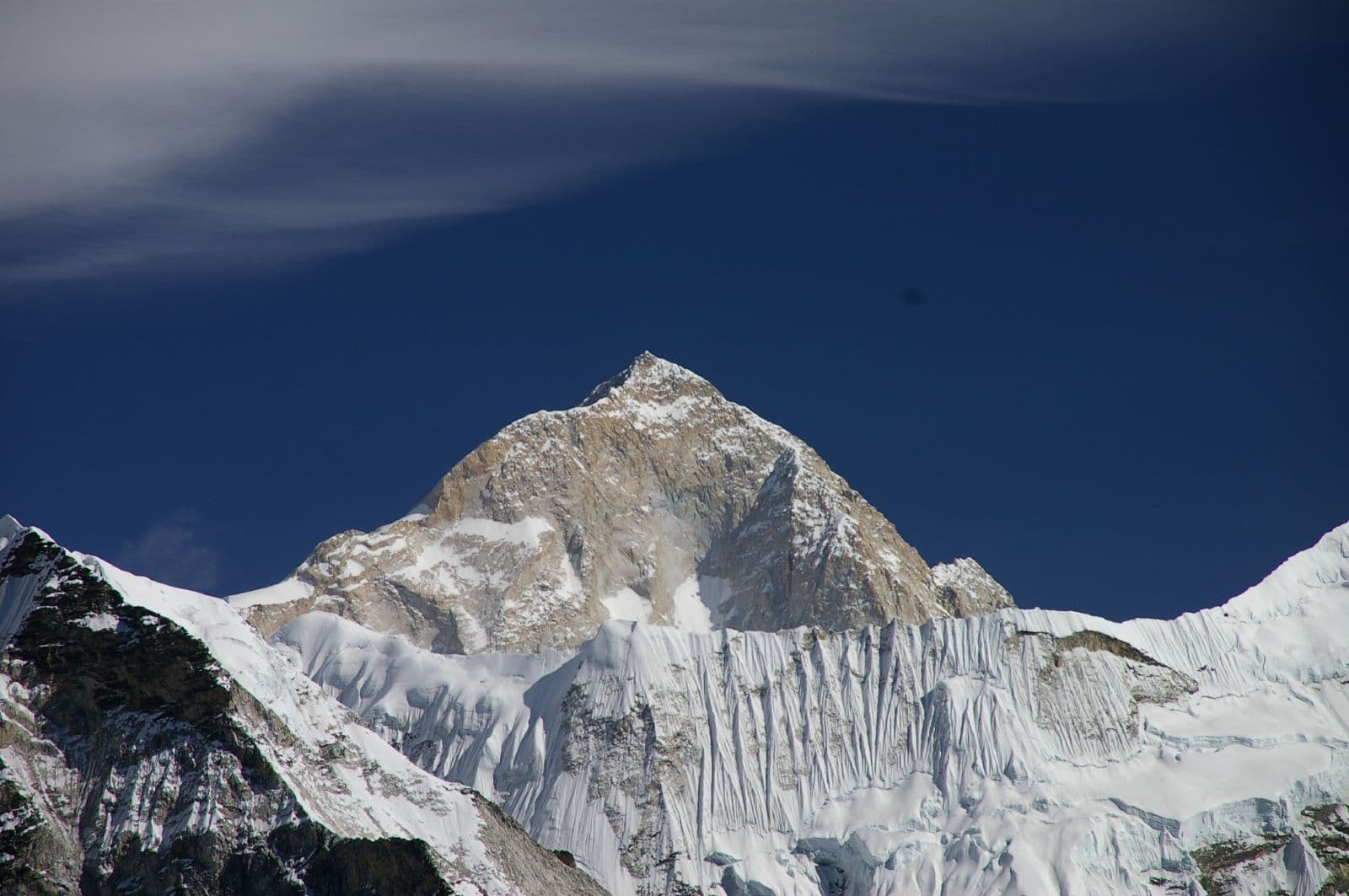
Mahalangur Himal, Koshi Province
Makalu
also मकालु हिमाल
8,485 m27,838 ft27.889°N 87.089°E
At a glance
- Elevation
- 8,485 m · 27,838 ft[1]
- Prominence
- 2,378 m[1]
- Range
- Mahalangur Himal[1]
- Region
- Sankhuwasabha District, Koshi Province[2]
- Coordinates
- 27.8892° N, 87.0886° E[1]
- First ascent
- 15 May 1955, Lionel Terray & Jean Couzy[2]
Elevation is height above sea level; prominence is how far it rises above the lowest col connecting it to higher ground.
The mountain's story
Makalu is the fifth-highest mountain on Earth, its summit reaching 8,485 metres in the Mahalangur Himal, 19 kilometres southeast of Everest on the China–Nepal border. It stands apart from its neighbours: an isolated peak shaped like a four-sided pyramid.[2]
Two satellite summits keep it company: Kangchungtse, or Makalu II, about three kilometres to the north-northwest, and Chomo Lonzo across a broad plateau to the north-northeast. A French reconnaissance in 1954 climbed both. The following spring, on 15 May 1955, Lionel Terray and Jean Couzy of Jean Franco's French expedition reached the main summit by the north face and northeast ridge, establishing what is still the standard route.[2]
Little things worth knowing
- 1
Two companions
Kangchungtse (7,678 m) and Chomo Lonzo (7,804 m) are Makalu's notable subsidiary peaks.[2]
- 2
Rehearsal first
A 1954 French reconnaissance made first ascents of both subsidiary summits before the main peak was climbed.[2]
- 3
Seen from Gokyo
Makalu is one of four eight-thousanders visible from the top of Gokyo Ri.[3]
Rivers from this mountain
Water that begins in its snow and ice, or drains the range around it.
Where it lives
Summit coordinates from Wikidata; hollow dots are viewpoints from which this peak is documented as visible.
Look closer
If you want to visit
Places from which Makalu is documented as visible:
- Gokyo Ri[3]
Permits, fees and access rules change. Check current requirements with the Nepal Tourism Board before you travel. We don't list routes or logistics we can't keep current.
Sources & further reading
4 sources
- [1]Wikidata item Q169986, Wikidata, retrieved 2026-10-23 · accessed 2026-10-23
- [2]Makalu, Wikipedia · accessed 2026-10-23
- [3]Gokyo Ri, Wikipedia · accessed 2026-10-23
- [4]Barun River, Wikipedia · accessed 2026-10-23
Structured values (elevation, coordinates, prominence) come from Wikidata, which aggregates survey sources. Wikipedia articles are used as secondary references; we prefer primary survey and expedition records as we add them. Last verified 2026-10-23.