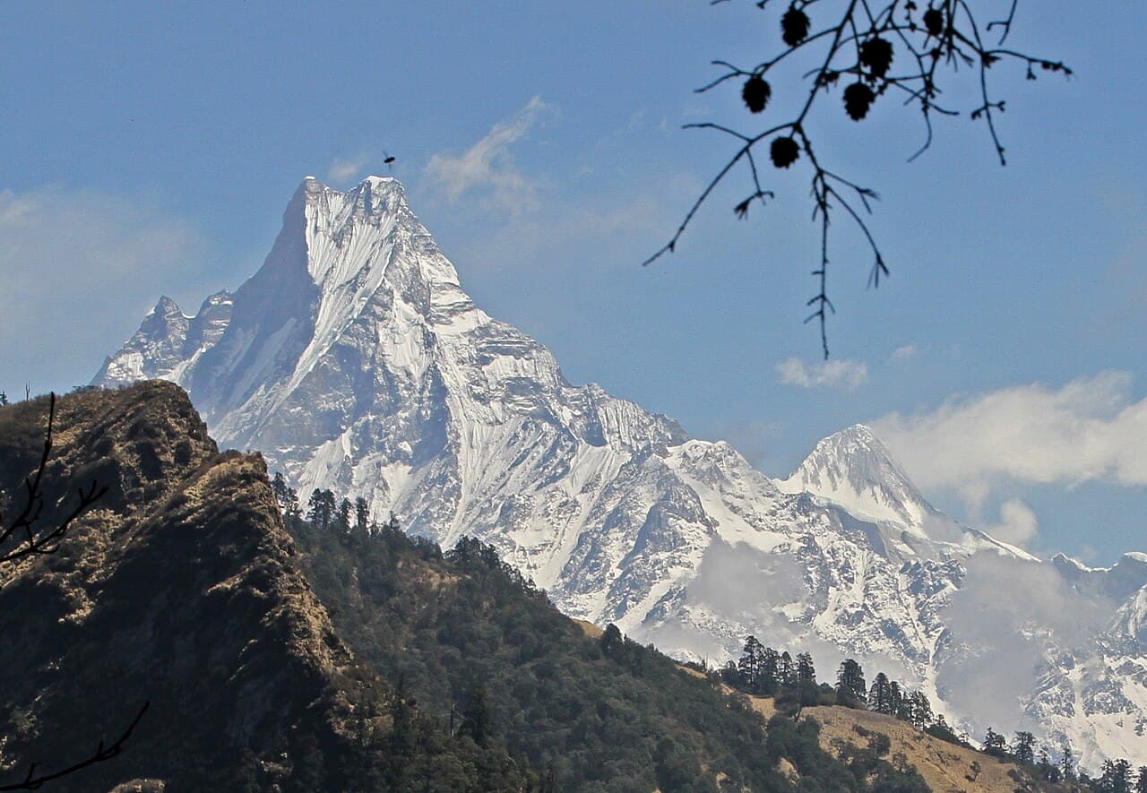
Annapurna Himal, Gandaki Province
Machhapuchhre
also माछापुच्छ्रे हिमाल · Machapuchare · Machhapuchchhre · Fishtail Mountain
6,993 m22,943 ft28.495°N 83.949°E
At a glance
- Elevation
- 6,993 m · 22,943 ft[1]
- Prominence
- 1,233 m[1]
- Range
- Annapurna Himal[2]
- Region
- Kaski District, Gandaki Province[2]
- Coordinates
- 28.4950° N, 83.9492° E[1]
- Nearby
- Chomrong[2]
Elevation is height above sea level; prominence is how far it rises above the lowest col connecting it to higher ground.
The mountain's story
Machhapuchhre (also written Machapuchare or Machhapuchchhre) is Nepali for 'fishtail'. At 6,993 metres it is lower than the eight-thousanders seen from the same valley, but it stands in the Annapurna massif closer to Pokhara than any of the other great peaks.[3][2]
It is a sacred peak for the Gurung people and the people of Chomrong, and is said to be home to the god Shiva. The summit has never been officially climbed: Nepal does not issue permits for it. The only confirmed attempt came in 1957, when Wilfrid Noyce and A. D. M. Cox of Jimmy Roberts's British team stopped about 150 feet below the top. King Mahendra had permitted the climb but forbidden them to set foot on the summit, and they complied.[2]
Little things worth knowing
- 1
Closest giant
Machhapuchhre is the closest of the big peaks to Pokhara.[3]
- 2
Unclimbed summit
Its highest peak has never been officially climbed, because the government of Nepal does not grant permits.[2]
- 3
150 feet short
In 1957 Noyce and Cox reached about 6,947 m on the north ridge, honouring a condition not to stand on the summit.[2]
Rivers from this mountain
Water that begins in its snow and ice, or drains the range around it.
Where it lives
Summit coordinates from Wikidata; hollow dots are viewpoints from which this peak is documented as visible.
Look closer
Culture & meaning
If you want to visit
Places from which Machhapuchhre is documented as visible:
Permits, fees and access rules change. Check current requirements with the Nepal Tourism Board before you travel. We don't list routes or logistics we can't keep current.
Sources & further reading
6 sources
- [1]Wikidata item Q1051394, Wikidata, retrieved 2026-10-23 · accessed 2026-10-23
- [2]Machapuchare, Wikipedia · accessed 2026-10-23
- [3]Pokhara, Wikipedia · accessed 2026-10-23
- [4]Modi River, Wikipedia · accessed 2026-10-23
- [5]Seti Gandaki River, Wikipedia · accessed 2026-10-23
- [6]Poon Hill, Wikipedia · accessed 2026-10-23
Structured values (elevation, coordinates, prominence) come from Wikidata, which aggregates survey sources. Wikipedia articles are used as secondary references; we prefer primary survey and expedition records as we add them. Last verified 2026-10-23.