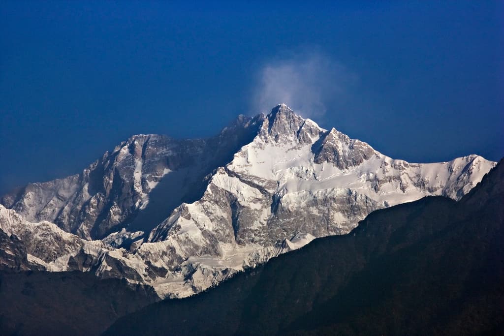
Kangchenjunga Himal, Koshi Province
Kangchenjunga
also कञ्चनजङ्घा हिमाल · Kangchenjunga · Kañcanjaṅghā · Kangchendzonga
8,586 m28,169 ft27.703°N 88.147°E
At a glance
- Elevation
- 8,586 m · 28,169 ft[1]
- Prominence
- 3,922 m[1]
- Range
- Kangchenjunga Himal[2]
- Region
- Taplejung District, Koshi Province[2]
- Coordinates
- 27.7030° N, 88.1474° E[1]
- First ascent
- 25 May 1955, Joe Brown & George Band[2]
Elevation is height above sea level; prominence is how far it rises above the lowest col connecting it to higher ground.
The mountain's story
Kangchenjunga is the third-highest mountain in the world, rising to 8,586 metres in the Kangchenjunga Himal. It sits on the border between Nepal's Koshi Province and the Indian state of Sikkim: its West and Kangbachen peaks lie in Nepal's Taplejung District, while the Main, Central and South summits sit directly on the border.[2]
Until 1852 it was assumed to be the highest mountain on Earth, until calculations by the Great Trigonometrical Survey showed that Peak XV (Everest) was higher. The mountain is considered sacred in Nepal and Sikkim. When Joe Brown and George Band made the first ascent on 25 May 1955, they stopped just short of the true summit, keeping a promise to the Chogyal of Sikkim that the top would remain untouched.[2]
Little things worth knowing
Rivers from this mountain
Water that begins in its snow and ice, or drains the range around it.
Tamurतमोर नदी
Rises on this mountain
Begins around Kangchenjunga; it later joins the Arun and Sun Koshi to form the Sapta Koshi.[4]
Where it lives
Summit coordinates from Wikidata.
Look closer
Culture & meaning
- Names and documented meaning
The name has been explained as 'the five treasures of the high snow', from Tibetan words for snow, great, and treasury.[2]
- Oral tradition, as recorded
According to the Lhopo people, the five treasures are hidden and reveal themselves to the devout when the world is in peril.[2]
If you want to visit
We haven't yet recorded a sourced viewpoint for this peak.
Permits, fees and access rules change. Check current requirements with the Nepal Tourism Board before you travel. We don't list routes or logistics we can't keep current.
Sources & further reading
4 sources
- [1]Wikidata item Q82019, Wikidata, retrieved 2026-10-23 · accessed 2026-10-23
- [2]Kangchenjunga, Wikipedia · accessed 2026-10-23
- [3]Khangchendzonga National Park, UNESCO World Heritage Centre · accessed 2026-10-23
- [4]Tamur River, Wikipedia · accessed 2026-10-23
Structured values (elevation, coordinates, prominence) come from Wikidata, which aggregates survey sources. Wikipedia articles are used as secondary references; we prefer primary survey and expedition records as we add them. Last verified 2026-10-23.