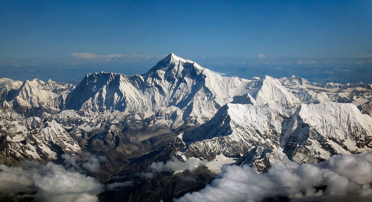
Mahalangur Himal, Koshi Province
Mount Everest
also सगरमाथा · Mount Qomolangma · Mount Sagarmatha · Chomolangma
8,848.86 m29,032 ft27.988°N 86.925°E
At a glance
- Elevation
- 8,848.86 m · 29,032 ft[1]
- Prominence
- 8,848.86 m[1]
- Range
- Mahalangur Himal[1]
- Region
- Solukhumbu District, Koshi Province[2]
- Coordinates
- 27.9881° N, 86.9250° E[1]
Elevation is height above sea level; prominence is how far it rises above the lowest col connecting it to higher ground.
The mountain's story
Known in Nepali as Sagarmatha, in Sherpa as Chomolangma and in Tibetan as Qomolangma, Everest is the highest mountain on Earth above sea level. It rises in the Mahalangur Himal, and its summit marks part of the border between Nepal and China. A joint survey by Nepalese and Chinese authorities in 2020 set its height at 8,848.86 metres.[2][1]
British surveyors first catalogued it as Peak XV. Surveyor General Andrew Waugh proposed naming it after his predecessor, George Everest, and the Royal Geographical Society adopted the name in 1865. On 29 May 1953, Tenzing Norgay and Edmund Hillary of John Hunt's expedition made the first documented ascent, by the South Col route. From much of the Khumbu the summit hides behind Nuptse, which is why trekkers climb Kala Patthar for a clear look.[3][2]
Little things worth knowing
- 1
Hidden summit
Nuptse blocks Everest's summit from much of the surrounding region; Kala Patthar offers the most accessible close-up view.[3]
- 2
A borrowed name
Waugh chose to name Peak XV after George Everest; the Royal Geographical Society officially adopted 'Mount Everest' in 1865.[2]
- 3
High fliers
George Lowe, a member of the 1953 expedition, reported seeing bar-headed geese flying over the summit.[2]
- 4
Protected ground
Everest lies within Sagarmatha National Park, a UNESCO World Heritage Site.[4]
Rivers from this mountain
Water that begins in its snow and ice, or drains the range around it.
Dudh Koshiदुधकोशी नदी
Rises on this mountain
Originates in the high-altitude areas around Mount Everest; snow and glacier melt supply much of its dry-season flow.[5]
Where it lives
Summit coordinates from Wikidata; hollow dots are viewpoints from which this peak is documented as visible.
Look closer
Culture & meaning
- Names and documented meaning
Sagarmatha is the mountain's Nepali name; Sherpa communities call it Chomolangma, and in Tibetan it is Qomolangma.[2]
If you want to visit
Places from which Mount Everest is documented as visible:
Permits, fees and access rules change. Check current requirements with the Nepal Tourism Board before you travel. We don't list routes or logistics we can't keep current.
Sources & further reading
8 sources
- [1]Wikidata item Q513, Wikidata, retrieved 2026-10-23 · accessed 2026-10-23
- [2]Mount Everest, Wikipedia · accessed 2026-10-23
- [3]Kala Patthar, Wikipedia · accessed 2026-10-23
- [4]Sagarmatha National Park, UNESCO World Heritage Centre · accessed 2026-10-23
- [5]Dudh Koshi, Wikipedia · accessed 2026-10-23
- [6]Nagarkot, Wikipedia · accessed 2026-10-23
- [7]Daman, Nepal, Wikipedia · accessed 2026-10-23
- [8]