Mahalangur Himal, Koshi Province
Ama Dablam
also आमा दब्लम हिमाल
6,814 m22,356 ft27.861°N 86.861°E
At a glance
- Prominence
- 1,027 m[2]
- Range
- Mahalangur Himal[2]
- Region
- Solukhumbu District, Koshi Province[1]
- Coordinates
- 27.8611° N, 86.8614° E[2]
- First ascent
- 13 March 1961, Gill, Bishop, Ward & Romanes[1]
Elevation is height above sea level; prominence is how far it rises above the lowest col connecting it to higher ground.
The mountain's story
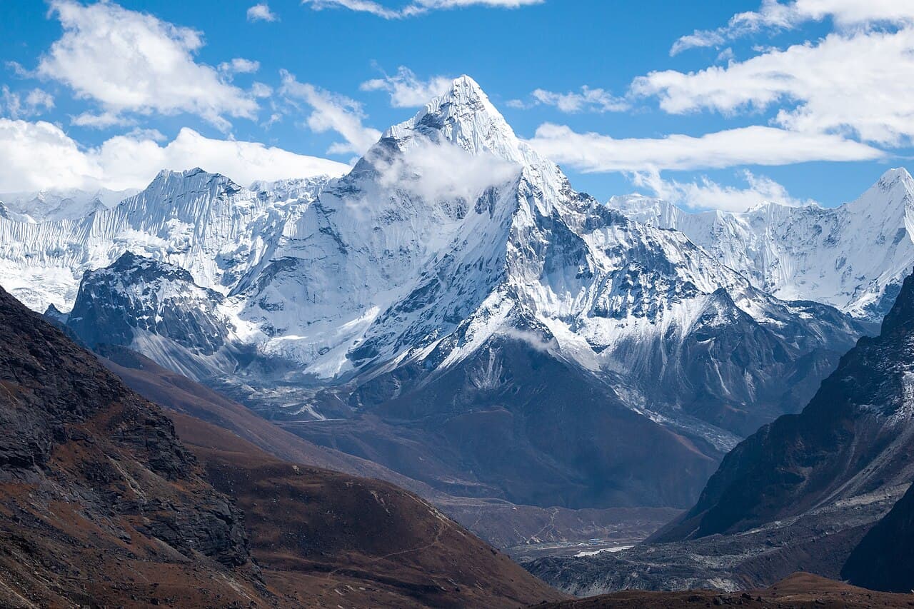
Ama Dablam's name in the Sherpa language means 'mother's charm box'. Its long ridges are seen as a mother's arms protecting her child, and its hanging glacier as the dablam, the double pendant holding images of the gods that Sherpa women traditionally wear. For days on the trek to Everest Base Camp it fills the eastern sky.[1]
Its soaring ridges and steep faces have earned it the nickname 'Matterhorn of the Himalayas', and it appears on Nepal's one-rupee banknote. The first ascent came on 13 March 1961, when Mike Gill, Barry Bishop, Mike Ward and Wally Romanes climbed the Southwest Ridge, well acclimatised after wintering at 5,800 metres on Edmund Hillary's Silver Hut expedition. Today it is one of the most popular Himalayan peaks for permitted expeditions.[1]
Little things worth knowing
Where it lives
Summit coordinates from Wikidata.
Look closer
Culture & meaning
- Names and documented meaning
In Sherpa, ama is 'mother' and dablam the double pendant, containing pictures of the gods, worn by Sherpa women. The hanging glacier is likened to it.[1]
If you want to visit
We haven't yet recorded a sourced viewpoint for this peak.
Permits, fees and access rules change. Check current requirements with the Nepal Tourism Board before you travel. We don't list routes or logistics we can't keep current.
Sources & further reading
2 sources
- [1]Ama Dablam, Wikipedia · accessed 2026-10-23
Note: Wikidata records 6,814 m; the Wikipedia article gives 6,812 m for the main peak. Published surveys differ by a few metres.
- [2]Wikidata item Q451697, Wikidata, retrieved 2026-10-23 · accessed 2026-10-23
Structured values (elevation, coordinates, prominence) come from Wikidata, which aggregates survey sources. Wikipedia articles are used as secondary references; we prefer primary survey and expedition records as we add them. Last verified 2026-10-23.